California is famous for its hundreds of miles of stunning beaches and coastlines. For visitors looking to escape from the city and take in the breathtaking views of the Pacific Ocean, a road trip up the coast is a great option. There are numerous different routes you can take, and visitors often want to know which is best. You might be wondering, is California State Route 1 the same as the 101?
California State Route 1 (Pacific Coast Highway) and US Highway 101 are two separate highways. The highways are often confused because they both follow the western coast of the United States and even connect at several points. For road trippers, the most popular choice is the Pacific Coast Highway.
Before planning your California road trip, you’ll want to understand which route is the best, what sites there are to see, and what you can do along the way. As you continue reading, you will learn more about the history, sights, and confusion around the 1 and the 101.
Highway 1 and The 101 – Are They the Same?
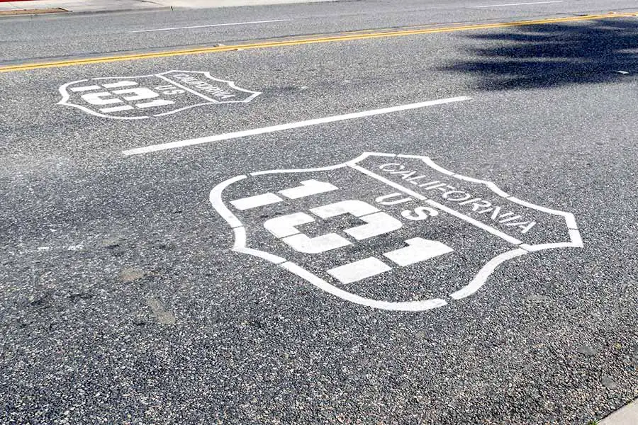
While California State Route 1 and US Route 101 follow a similar path up the coast of California, they are two different highway systems. These two highways are often confused because their nomenclature is similar. Also, there are stretches where the 1 and the 101 run together.
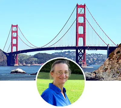
For example, there is a 54 mile stretch in Ventura and Santa Barbara counties where the two highways share the same road. Also, if you are crossing the Golden Gate Bridge in San Francisco, you are driving on both SR 1 and US 101.
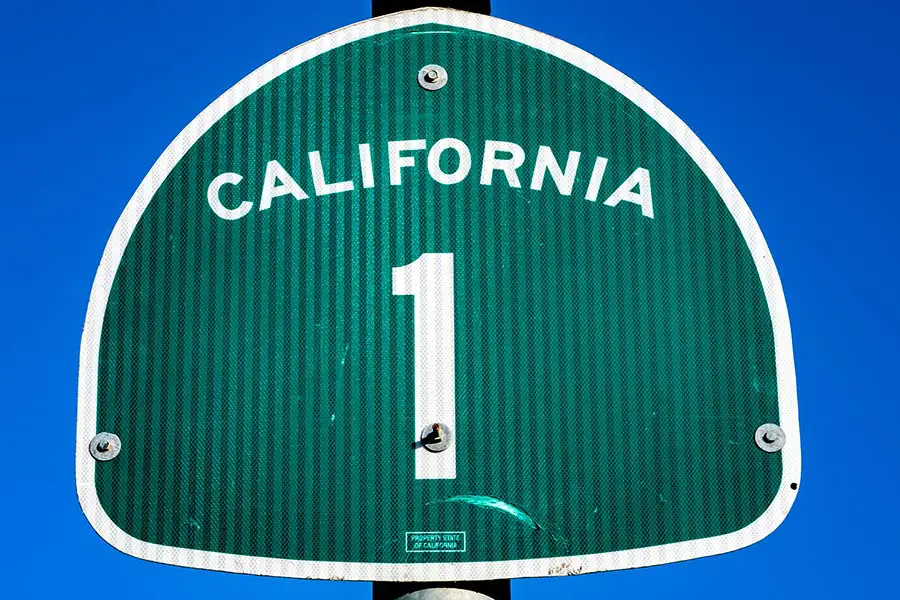
California State Route 1 (commonly referred to as Pacific Coast Highway or simply “PCH” by locals) is 655 miles long and stretches from Dana Point in Southern California to Leggett in Mendocino County (around 4 hours north of San Francisco).
The PCH is the longest state route in California and the second-longest in the US after Montana Highway 200. This highway is mostly two lanes the entire way and features no tolls (except for the southbound crossing of the Golden Gate Bridge).
US Route 101 was built to connect the entire west coast of the United States. Today, the 101 runs from the heart of Los Angeles to Tumwater, Washington. The total length of US Route 101 is 1540 miles.
The US 101 is mostly free but has some sections with special toll lanes to help commuters get ahead of traffic for a fee. In addition, the highway is a bit wider in some places, with up to 8 lanes or so on each side.
Even though US Route 101 connects California, Oregon, and Washington, it is not technically considered an interstate highway. This is because interstate highways don’t typically have traffic lights and can only be accessed with on/off ramps.
This designation doesn’t apply to US Route 101, which winds through dozens of small towns and urban areas throughout the state and has traffic lights and stop signs.
How Long Does It Take to Drive the Pacific Coast Highway?
Many visitors dream of driving the full length of the Pacific Coast Highway. The entire PCH drive can take 10-12 hours without any stops. You should plan to make stops along the way to check out the many great coastal towns like Bodega Bay, see the elephant seals at Point Reyes National Seashore, do some hiking at Mount Tamalpais State Park and enjoy the marvelous ocean views.
To get the best experience, you should plan at least 2-3 days for the entire PCH trip. If you are short on time, the section of the PCH that runs between Santa Monica and Monterrey has the best views and can be completed in 6-8 hours.
Other Posts of Interest
- What Is John Muir Known For?
- What Is The Name Of The Submarine In San Francisco?
- Is It Hard To Drive In San Francisco?
- Is It More Expensive To Live In San Francisco Or Los Angeles?
Bay Area Answers Fun Fact: Californians always add the word “the” before any highway name. For example, when asking for directions, a California native will tell you to take “the” 101. This subtle difference can quickly identify you as a tourist from out of state.
Construction of the Pacific Coast Highway
The construction of what would eventually become the Pacific Coast Highway began in 1910. The highway was constructed as separate segments up and down the California coast but was joined together into a single highway in 1934.
The PCH was complicated and expensive to build. One of the most challenging parts to complete was the stretch along the Big Sur coast. This section required the construction of 33 bridges so vehicles could cross the many steep ravines. This section (originally named Route 56) took over 18 years to complete.
The Pacific Coast Highway is more susceptible to landslides and erosion due to its proximity to the ocean and steep terrain. It’s pretty common to have large sections closed for construction or repair, so be sure to check ahead for any road closures. The highway continues to be costly to California taxpayers to maintain and repair today.
Is the Pacific Coast Highway Dangerous to Drive?
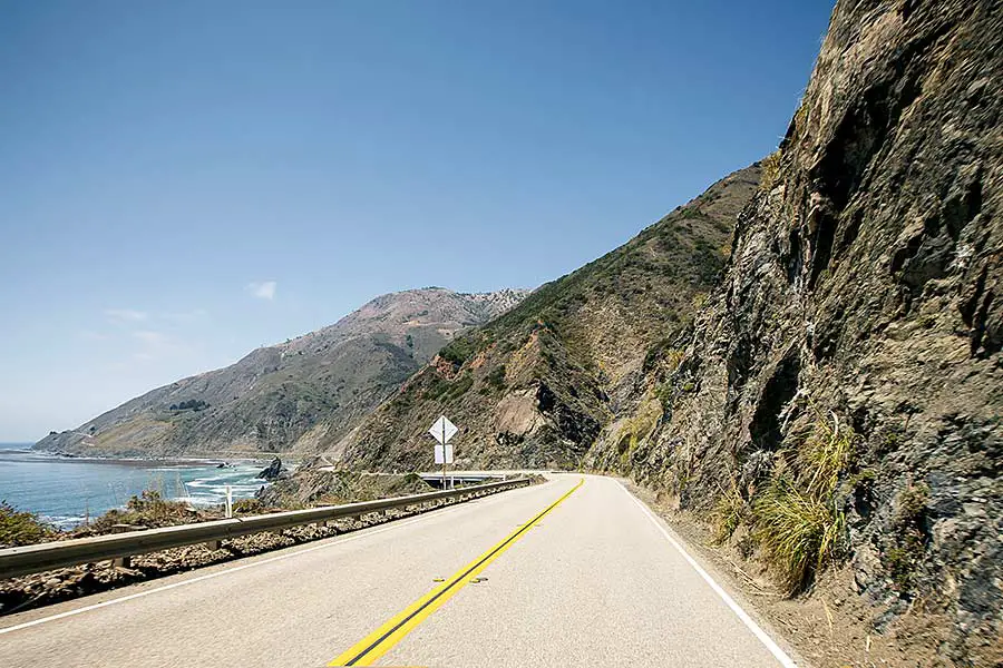
While it is generally safe to drive the Pacific Coast Highway, there are some dangers and hazards that you should be mindful of before your trip. First, several sections feature narrow, curvy roadways, many of which have limited guardrails along steep ocean cliffs.
Drivers who become distracted by the fantastic views can increase their chance of getting into an accident or running off the road. If you are traveling with other adults, it’s best to take turns driving, so everyone gets the chance to check out the views.
Also, because the highway features two lanes most of the way, impatient drivers may drive faster or pass others when it isn’t safe. If you notice that a line of cars is backing up behind you, there are lots of places that you can pull off the road and let them pass. Use it as an opportunity to get out, stretch your legs, and take in the views.
What’s the Best Time of Year to Drive the Pacific Coast Highway?
California is known for its incredible year-round weather. Therefore, you can drive the PCH route any day of the year. However, it’s best to go any time between late spring and early fall to avoid the rainy weather.
Rain can decrease visibility, make the roadways slick, and increase the chances (although unlikely) of getting stuck behind a landslide. The middle of summer will provide the best weather for your road trip, but keep in mind this is when the highway will be the most congested, and the price of hotels along the way will go up.
What is the Most Scenic Part of the Pacific Coast Highway?
So which section of the PCH is the prettiest? That is a bit of a tough question to answer because there are so many great places to see along the Pacific Coast Highway, including the Golden Gate Bridge, classic California coastal towns like Carmel by the Sea, and sweeping views of the Pacific Ocean.
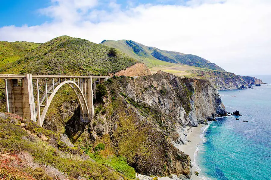
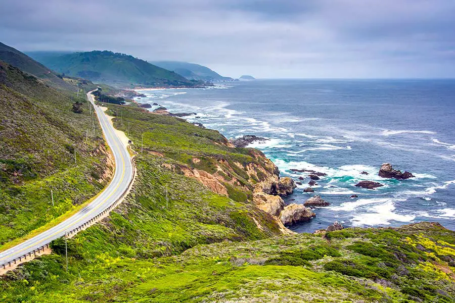
However, Big Sur is considered the most beautiful part of the PCH.
This section of highway runs between Carmel and San Simeon. On one side of the road, you will see the vast expanse of blue over the ocean with the Santa Lucia Mountains to the other side. Visitors passing through Big Sur often make stops at the many state parks and beaches along the highway.
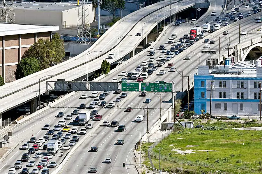
Does the 101 Go Through Los Angeles?
US Route 101 is one of the best highways to take if you want to see downtown Los Angeles up close. However, it’s one of the worst highways to be on during rush hour. It’s easy to get stuck for hours, so be sure to plan your trip around peak driving times.
Can You See the Pacific Ocean From the 101?
The Pacific Coast Highway is a better route if you want to get the most views of the Pacific Ocean. The 101 takes a more inland route most of the way, but there are some places where you can see the ocean.
US Route 101 is a great alternative to the Pacific Coast Highway because of the diverse scenery. Along the way, you will see many of the remarkable landscapes that California has to offer, including rolling hills, agricultural areas, the sprawling metropolis of the San Francisco Bay Area, and Silicon Valley.
The 101 also passes through several California wine regions in both Northern California (like Sonoma County) and Southern California (like Paso Robles). As the 101 reaches Northern California, the landscape changes to large wooded areas of coniferous trees.
Preparing for Your California Road Trip
Planning ahead is the best method to get the most out of your California road trip. Over the years, the PCH has faced many challenges and closures from rock and landslides. So you’ll want to check ahead of your trip to make sure your chosen route is open. The last thing you want to happen is to have to scramble at the last minute to rework your itinerary.
Also, during the summer months, you might experience high volumes of tourists trying to get to the same destination as you. An essential point to remember is to take your time and enjoy the ride!