While impressive in size and scope, the massive San Francisco Bay can get in the way of the thousands of Bay Area commuters who need to quickly get from Point A to Point B, especially when Point B is their workplace. Fortunately for such a commuter-heavy area, miles of freeway and roads are supported by strategically placed bridges that span 23 miles of Bay water. But how many bridges are there?
The Bay Area has eight toll bridges that span various parts of the enormous San Francisco Bay. While the Golden Gate Bridge is the granddaddy of them all, each of the Bay’s bridges is distinctive and valuable in its own right as they help keep traffic moving in the densely populated Bay Area.
Most importantly, the eight bridges connect all the Bay Area regions, making it easier to get from one far-flung location to another, which is vital in an area where people drive great distances to get to and from their workplace. Each of the bridges has its own story to tell and distinctive design aesthetics, so read on to learn more about the bridges of the Bay Area.
The Bridges of the Bay
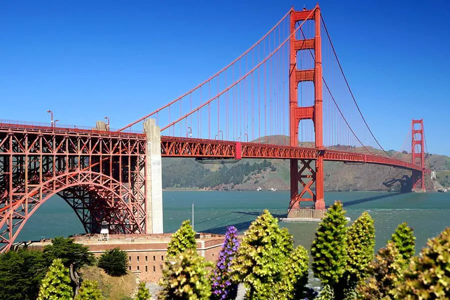
Golden Gate Bridge:
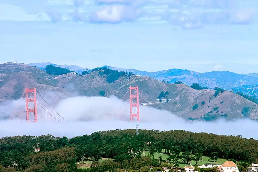
Spanning the 1.7-mile length of the Golden Gate Strait that separates the Pacific Ocean from the San Francisco Bay, the Golden Gate Bridge needs no introduction. It’s distinctive “International Orange” color and 750-foot tall towers make it one of the world’s most recognizable architectural landmarks and an iconic symbol of the city.
The bridge opened in 1937 and connects San Francisco with Marin County to the north, and is a major commuter route. An estimated 2.35 billion vehicles have crossed since its opening. With 110,000 vehicles crossing the bridge daily, its six lanes of roadway are modified throughout the day to adapt to changing traffic patterns to help traffic flow. While driving the bridge is indeed a thrilling experience for visitors, walking or biking across the bridge is the best way to get the full-on Golden Gate Bridge experience.
Bay Area Answers Fun Fact: 300,000 people packed the Golden Gate Bridge on May 24, 1987, when the city held a bridge walk to celebrate the 50th anniversary of the bridge’s opening. With so many people’s weight, the middle of the bridge sagged seven feet, causing the bridge to flatten. The bridge was quickly closed, but since it was built to bend, it was never in any danger of collapsing.
San Francisco-Oakland Bay Bridge:
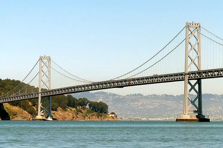
San Francisco’s “other” bridge, the San Francisco-Oakland Bay Bridge (or simply “Bay Bridge”), is the Bay Area’s most heavily traveled bridge and the third busiest bridge in the country, carrying approximately 247,720 vehicles every day. The Bay Bridge connects San Francisco with densely populated East Bay communities like Oakland, Berkeley, Alameda, and Richmond.
Completed in 1936, the Bay Bridge is actually two separate bridges: a two-tiered suspension span from San Francisco to Yerba Buena Island and a single tower, self-anchored suspension bridge between the island and Oakland. Together they form one of the longest spans in the United States. The eastern/Oakland span features a protected bicycle and pedestrian pathway where you can take in San Francisco views from a completely different perspective.
Other Posts of Interest:
- How Long Does It Take to Walk Across the Golden Gate Bridge?
- Is it Hard to Drive in San Francisco?
- How Do You Get Around on Angel Island?
- Is San Francisco an Island or a Peninsula?
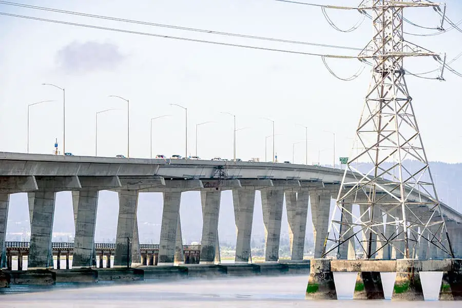
San Mateo-Hayward Bridge:
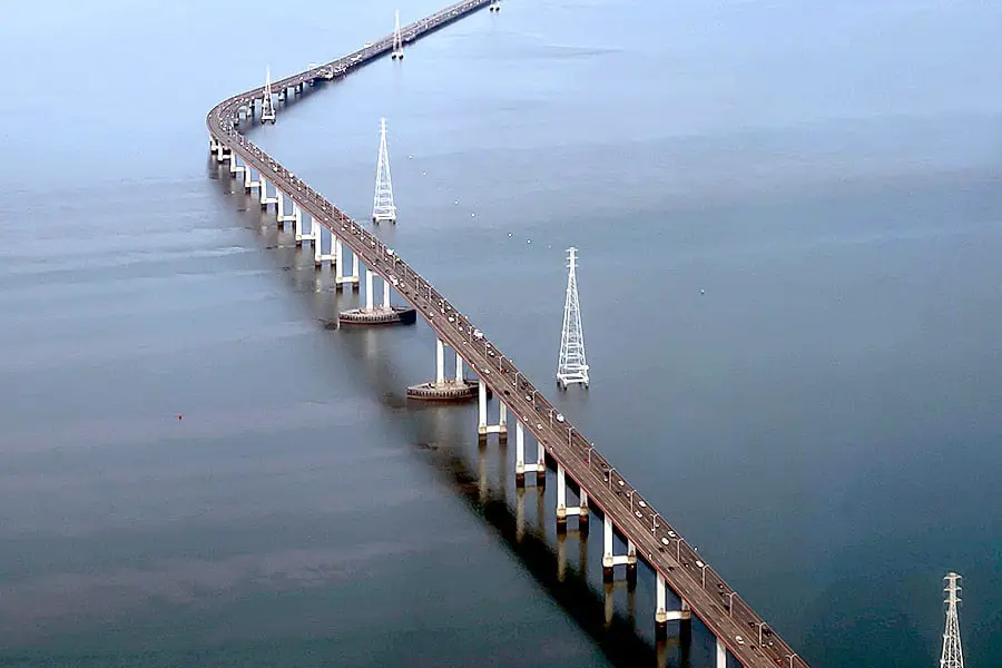
Opened in 1967, the San Mateo-Hayward Bridge crosses the Bay to link the Easy Bay with the Peninsula, offering drivers in those communities faster access to San Francisco International Airport (SFO). Its eastern end is in the East Bay city of Hayward, and its western end is in Foster City in San Mateo County on the Peninsula. On average, the bridge carries about 115,712 vehicles daily.
Designed with aesthetics in mind, unique and innovative architectural design makes it the world’s longest untraced girder span, meaning there are no towers or visible support structures. When seen from above, it resembles a long, thin ribbon cutting across the Bay. It’s the longest bridge in California and the 25th longest bridge in the world at seven miles in length.
Richmond-San Rafael Bridge:
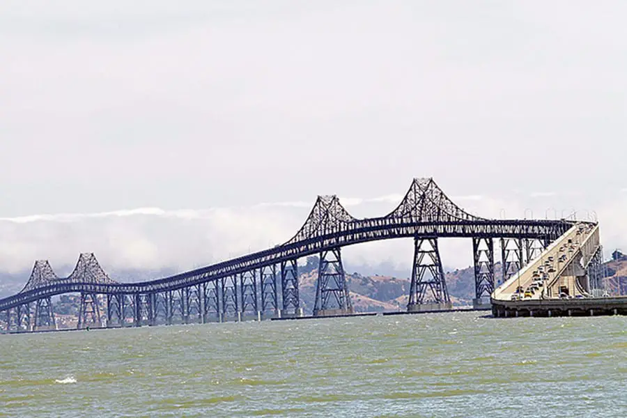
The Richmond-San Rafael Bridge bridges I-580 from the city of Richmond on the east to San Rafael on the west, linking North Bay and Contra Costa County with Marin County and the Sonoma and Napa Valley wine regions. It is the northernmost of the east-west Bay crossings.
Often derided for its lack of aesthetics and its less famous prestige of other Bay Area bridges, at 5.5 miles in length, it’s one of California’s longest bridges. For over 50 years, it has been serving thousands of drivers, with 78,750 vehicles crossing its scenic views of the San Francisco Bay daily.
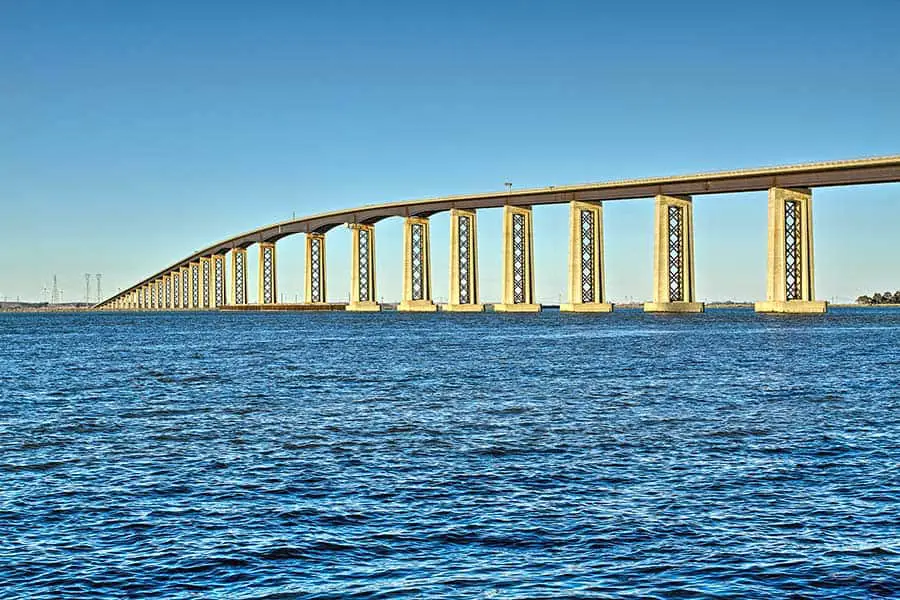
Dumbarton Bridge:
The first of the Bay bridges, the Dumbarton Bridge was originally built in 1927 and replaced in 1984 with an earthquake-retrofitted structure that efficiently moves traffic while being aesthetically pleasing. Like the San Mateo-Hayward bridge, it has a long, ribbon-like design that lacks towers. At 1.6 miles in length, it is the shortest of the Bay bridges.
It’s also the southern-most of the Bay bridges, crossing the narrowest portion at the Bay’s southern end. Carrying 76,334 vehicles daily, it connects San Mateo County and the Peninsula with Alameda County across the Bay. Its main job is to relieve congestion along the heavily traveled commuter route between the East Bay and the lower Peninsula. It has a pedestrian and biking walkway on its south side.
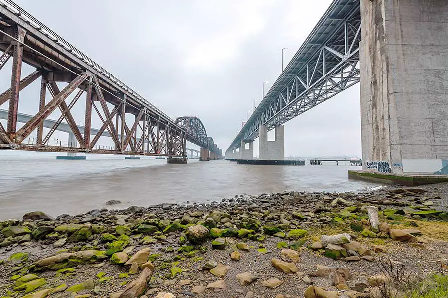
Carquinez Bridge:
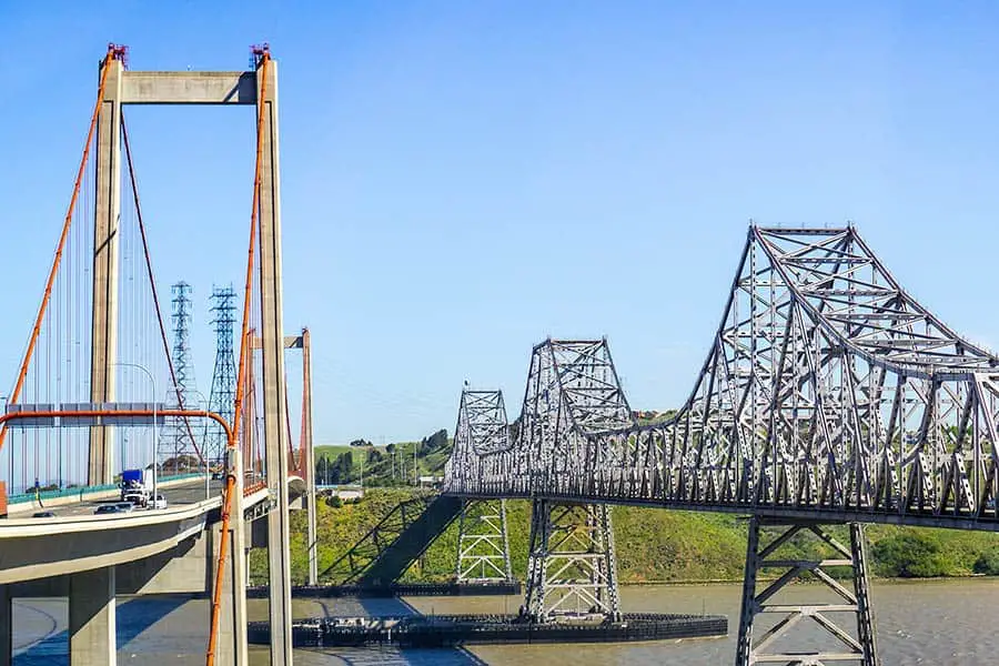
The Carquinez Bridge is actually two bridges that sit side by side as they span the northeastern end of the Bay at the Carquinez Strait, forming part of I-80 between Contra Costa and Solano Counties near the cities of Vallejo and Crockett. Built in 1927, the first Carquinez Bridge formed a direct route between San Francisco and Sacramento.
A second parallel bridge was built in 1958 to alleviate increased traffic congestion on the first bridge. Due to earthquake concerns, the 1927 bridge was replaced in 2003 with the Alfred Zampa Memorial Bridge that carries westbound traffic 3.5 miles across the Strait. It carries approximately 117,898 vehicles every day and features a dedicated pathway for pedestrians and bikers.
Benicia-Martinez Bridge:
The Bay’s fourth most traveled bridge, the Benicia-Martinez Bridge is actually two bridges that span the Carquinez Strait between the industrial North Bay cities of Martinez to the south and Benicia to the north, joining Solano and Contra Costa Counties on I-680. Another heavily traveled Bay bridge that measures about 1.7 miles in length and carries approximately 111,786 vehicles daily.
Antioch Bridge:
The Bay Area’s least traveled bridge, the Antioch Bridge, is the only bridge that extends outside of the nine-county Bay Area, crossing the San Joaquin River in northern Contra Costa County to link the city of Antioch with southern Sacramento County. Staying on I-160 after crossing the bridge puts drivers on a direct route to the city of Sacramento.
The original span, opened in 1926, was replaced in 1978 with a modern automobile, bicycle, and pedestrian bridge that is as gorgeous as it is functional. 1.8 miles in length, it carries approximately 16,146 vehicles daily.
Bay Area Answers Fun Fact: The combined vehicles crossing the eight Bay bridges total an incredible 874,346 vehicles daily!
Things to Know About Driving Bay Area Bridges
Commute Hours
The Bay Area’s highways and bridges do a great job of keeping traffic moving, but it’s best to avoid them at peak commute time, defined as Monday through Friday from 5 to 10 AM and 3 to 7 PM. The toll plaza backup at the Bay Bridge alone is the stuff nightmares are made of. Commuters might not have a choice, but visitors are advised to avoid driving during commute hours at all costs.
Tolls
Excluding the Golden Gate Bridge and San Francisco-Oakland Bay Bridge, tolls for the bridges listed here are $6 for passenger vehicles and $3 for carpools and motorcycles. A one-way fare to drive across the Golden Gate Bridge is $8.40, and visitors should be aware that cash and credit cards are not accepted on the Golden Gate Bridge. More on that in a moment.
Tolls for the Bay Bridge are $7 Monday through Friday during peak commute hours (5 AM to 10 AM, 3 PM to 7 PM), $5 Monday through Friday during non-peak hours, and $6 all day Saturday and Sunday.
Payment
Cash is accepted at the seven other bridges, but credit cards are not. The best means of toll payment for all Bay Area bridges is the FasTrak pre-paid electronic toll payment system. FasTrak users pay a discounted toll rate and have access to dedicated express lanes that speed past tollbooth lines. FasTrak can also be used to pay for parking at San Francisco International Airport. Just passing through and only need to cross a bridge once? Click here for information on one-time fare payments. Click here on where to find toll plazas at each of the Bay Area bridges.
Summing It Up
Just like the Bay Area itself, the local bridges are a diverse bunch with interesting histories and backstories. With various architectural designs, they’re a pretty good-looking group too. But mostly, they are instrumental in helping Bay Area traffic run smoothly and efficiently, something both locals and visitors alike can appreciate.