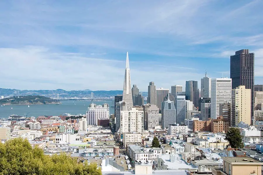
One of the first things people ask when you tell them you live in San Francisco is, “Aren’t you afraid of earthquakes?” Maybe this is because throughout the years, earthquakes and San Francisco have become synonymous with each other like the city continually sits on the edge of doom as residents live in constant fear of the next “big one.”
Earthquakes in San Francisco are so few and far between that locals rarely think about them, and even when they happen, they are generally centered miles from the city. Despite misconceptions driven mostly by myth and movies, San Francisco is not a dangerous city that’s constantly rocking and rolling.
Still, those middle-of-the-night magnitude 3.0 shakers can be enough to rattle even the most earthquake-hardened San Franciscan and act as a not-so-subtle reminder that the entire Bay Area is one of the world’s most seismic and earthquake-prone regions. But what seismic mojo is at work that makes San Francisco and the Bay Area such an earthquake prone place? Let’s find out.
How Many Bay Area Earthquakes Occur Each Year?
The Bay Area experiences hundreds of earthquakes a year. According to statistics from Earthquake Track.com, the Bay Area had 386 quakes of magnitude 1.5 or higher in 2020, with 42 of those quakes occurring in the month of December. Because the magnitudes were so low, most of those quakes were barely felt, and the damage was minimal to non-existent. Since 1836 there have been just five earthquakes in the San Francisco Bay Area with a 6.75 or higher magnitude. Two of these will go down in history as the most devastating to ever hit the city.
What Does an Earthquake Feel Like?
No two earthquakes are alike, and each has its own distinctive characteristics. Some are “shakers” that can last seconds or minutes on end. Some are “rollers” that you can hear rolling towards you with a sound that’s not unlike a locomotive until it hits directly underneath, and then everything shakes violently.
Others are “punchers,” which literally feel like a single, powerful punch. In some ways, these are the scariest, as they cause the most intense shaking. In these stronger quakes, objects fall off shelves, potted plants whip back and forth, windows rattle, dogs and cats freak out, and nerves become frayed. While the experience can be described as unique, it’s not something you want to relive over and over again.
Living On the Fault Line
The Bay Area has the misfortune of being home to seven major fault lines; the San Andreas, the Calaveras, Concord-Green Valley, Greenville, Hayward, Rodgers Creek, and San Gregorio faults. With the San Andreas, Hayward, and Calaveras fault zones being the most dangerous.
A fault line is described as a fracture along which the earth’s crust has moved. Stresses in the crust along plate boundaries break it into separate fragments that move relative to each other along fault lines.
Seismic waves are generated as the two sides of the fault quickly slip past each other, releasing tremendous amounts of energy. Of the Bay Area’s many fault lines, the infamous San Andreas fault is probably the best known, as it has been responsible for some of California’s most significant quakes.
Bay Area Answers Fun Fact: According to WorldAtlas.com, the five most earthquake-prone cities in the world are (in order) Tokyo, Japan, Jakarta, Indonesia, Manila, Philippines, San Francisco, United States, and Osaka, Japan. Japan, Indonesia, China, Iran, and Turkey are the world’s most seismically active countries. The United States comes in #7 on that list.
Other Posts of Interest
- What Is Winter Like in San Francisco?
- Is San Francisco an Island or a Peninsula?
- How Do You Get Around on Angel Island?
- How Many Bridges Are in the San Francisco Bay Area?
The San Andreas Fault
One of the world’s largest faults, the San Andreas Fault Zone, runs for nearly 750 miles through California, marking the boundaries of two tectonic plates that geologists divide into northern and southern segments known as the North American and Pacific Plates. For thousands of years, the two have been grinding against each other at a boundary called the strike-slip fault. Both plates crisscross with dozens of active and passive earthquake faults.
The San Andreas fault is a shallow fault extending four to ten miles into the earth’s crust, and this is notable because shallow fault earthquakes are more destructive at the surface than those originating from deep-seated faults.
Somewhat discomforting is the fact that a network of 500 active California faults feed into the San Andreas, so it’s impossible to live anywhere in the Bay Area without being near at least one fault line. Yet, despite what people think, the San Andreas Fault does not go directly through San Francisco.
The Hayward Fault Zone
Another dangerous Bay Area fault is the Hayward Fault that bisects the densely populated East Bay. The Hayward Fault Zone runs for about 74 miles along the western base of the East Bay hills. This fault runs parallel to the San Andreas Fault, and it merges with the Calaveras Fault east of the heavily populated South Bay city of San Jose. Because of its close proximity to so many dense urban centers, geologists call it one of the world’s most dangerous fault zones, with the highest probability of producing a magnitude 6.7 or larger quake in the next 30 years.
The Great Earthquake and Fires of 1906
San Francisco’s most destructive earthquake is the 1906 quake that leveled 80% of the city, killed an estimated 3,000 people, and left nearly 300,000 of the city’s 410,000 residents without homes. Striking at 5:12 AM on the morning of April 18, 1906, the magnitude 7.6 earthquake shook the city for a whopping 42 seconds, spreading northward and southward for a total of 296 miles. Centered on the San Andreas Fault, the quake was felt from Los Angeles to Oregon and as far inland as central Nevada.
As if the destruction caused by the quake weren’t enough, the resulting fires caused by ruptured gas lines were even worse. The city’s wooden structures were no match for the fires that raged for four days and nights following the quake. Since most of the city’s water mains had also burst, there was very little water available to extinguish the flames. Fires alone destroyed 25,000 buildings and were blamed for 90% of the quake’s total destruction.
Like a phoenix, it did not take San Francisco long to rise from the ashes of the 1906 earthquake, and the rebuilding efforts would shape the architectural look of modern-day San Francisco.
Every year, the quake is still commemorated on April 18 at historic Lotta’s Fountain at the downtown intersections of Market, Geary, and Kearney Streets. The fountain was the only monument left standing after the quake and served as a meeting place for survivors looking to be reunited with family or friends.
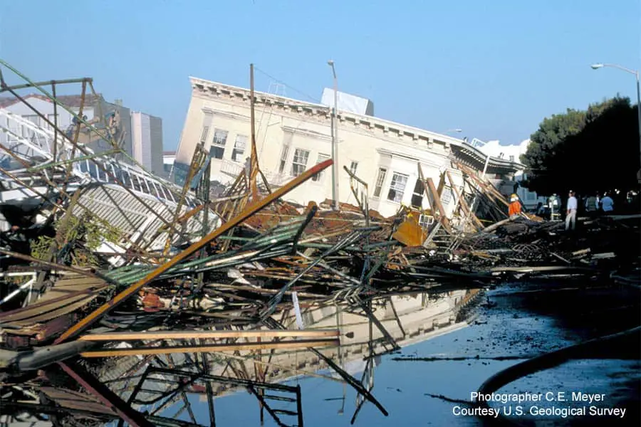
The Loma Prieta Earthquake of 1989
The Bay Area enjoyed a 68-year major earthquake-free period from 1911 until 1979 when a rash of escalating seismic events rattled the Bay Area, culminating with the magnitude 6.9 Loma Prieta earthquake that struck at 5:05 PM on October 17, 1989. It devastated large parts of the Bay Area and San Francisco, killing 67 people, injuring 3,757 others, and causing more than $6 billion in damages. The shaking lasted 20 seconds and was felt as far away as San Diego and western Nevada.
The most severe damage was in San Francisco and Oakland, but communities throughout the region, including Alameda, Watsonville, Santa Clara, Santa Cruz, and Monterey were also affected. A magnitude 5.2 aftershock occurred approximately 2 minutes after the main quake and in the following week, 20 aftershocks of magnitude 4.0 or greater and more than 300 of magnitude 2.5 or greater were recorded. Thousands of aftershocks were recorded in an aftershock zone that stretched 25 miles.
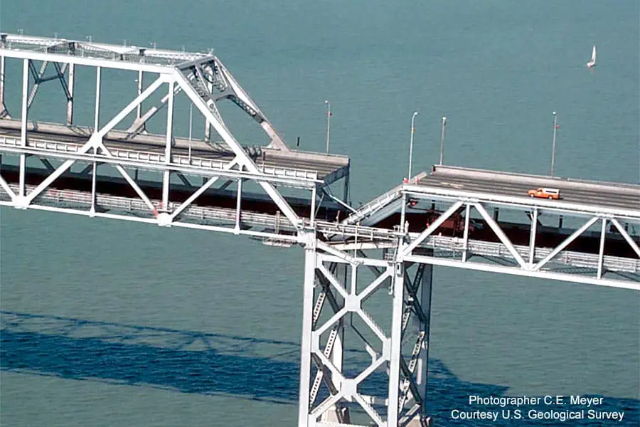
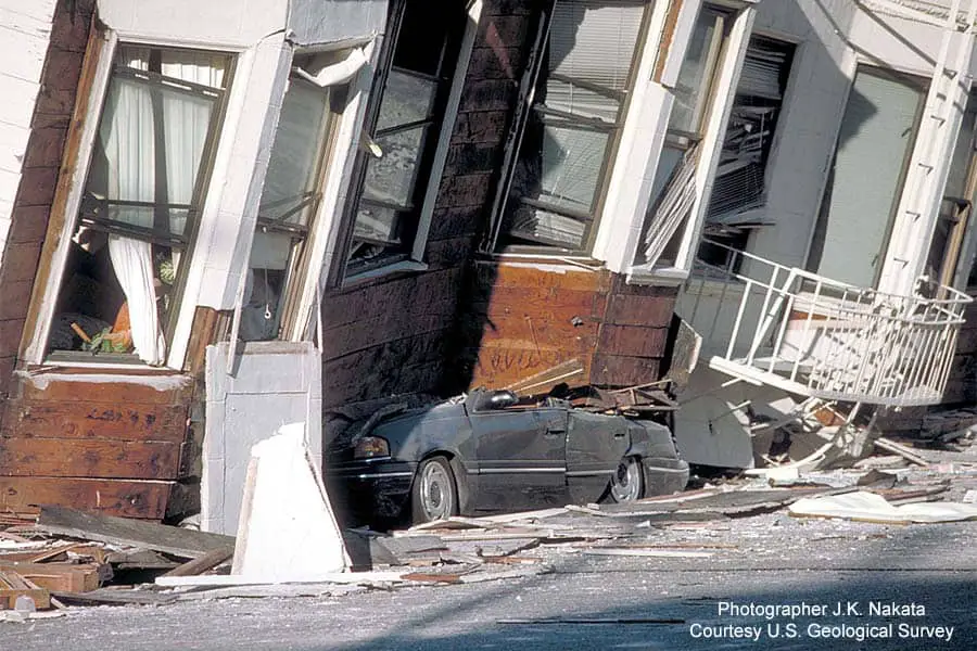
Even though its epicenter was nearly 100 miles away, Loma Prieta caused significant damage to San Francisco. The city’s Marina District, built on land reclaimed from the Bay, took the brunt of the damage. Liquefaction, a process that occurs when extreme shaking turns loose, sandy ground materials into a form of quicksand, caused dozens of buildings to collapse, bursting gas and water lines, sparking several fires, and killing four people. The quake also caused a segment of the top deck of the Bay Bridge’s eastern span to collapse into the deck below during rush hour traffic, a horrific event that was seen on national TV.
The aftermath of the Loma Prieta Earthquake saw Bay Area communities make sweeping changes to their earthquake preparedness practices, including newer, stricter building codes and stringent new earthquake retrofitting regulations required for structures of a certain age. The eastern span of the Bay Bridge was replaced entirely, a process that took nearly 11 years.
When Is The Next Big One?
While no one can correctly predict when the next “big one” will strike the San Francisco Bay Area, geologists with the United States Geological Survey (USGS) predict a 72% chance that one or more quakes of a magnitude 6.7 or larger will occur within the next 30 years. While it can’t be said for sure when or if that will happen, it’s still enough the give locals something to think about.